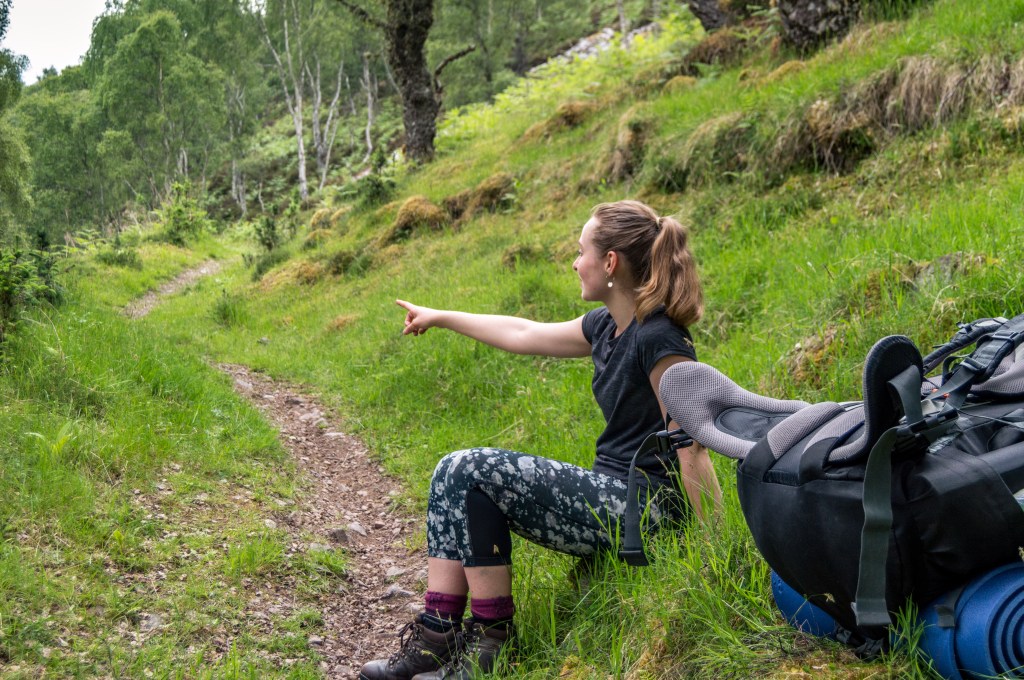
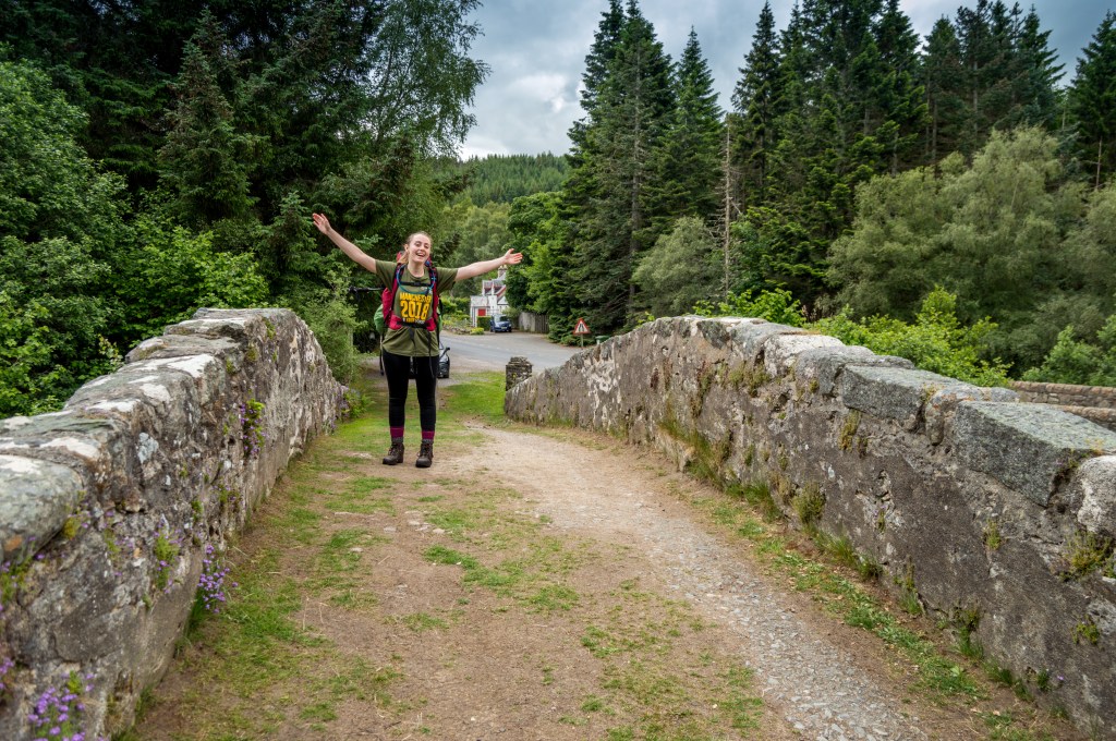
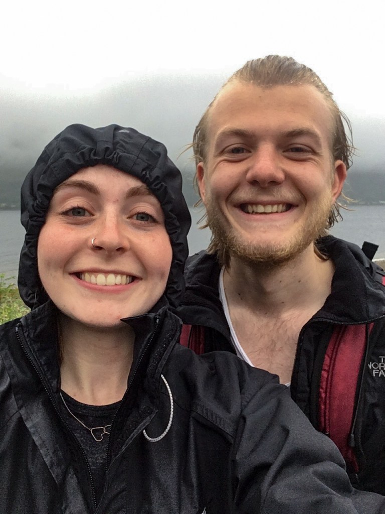
Wild camping in Scotland has long been a dream of mine. To be entirely immersed in nature, roaming with no real plan of where I would visit or how long I would stay. This summer I had the opportunity to live out this dream as Caitlin and I filled a couple of backpacks and headed north, to the Scottish Highlands.
This is a summary of our adventure through the Great Glen.
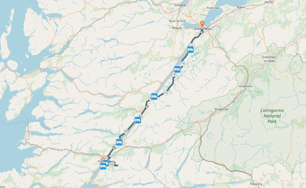
The route
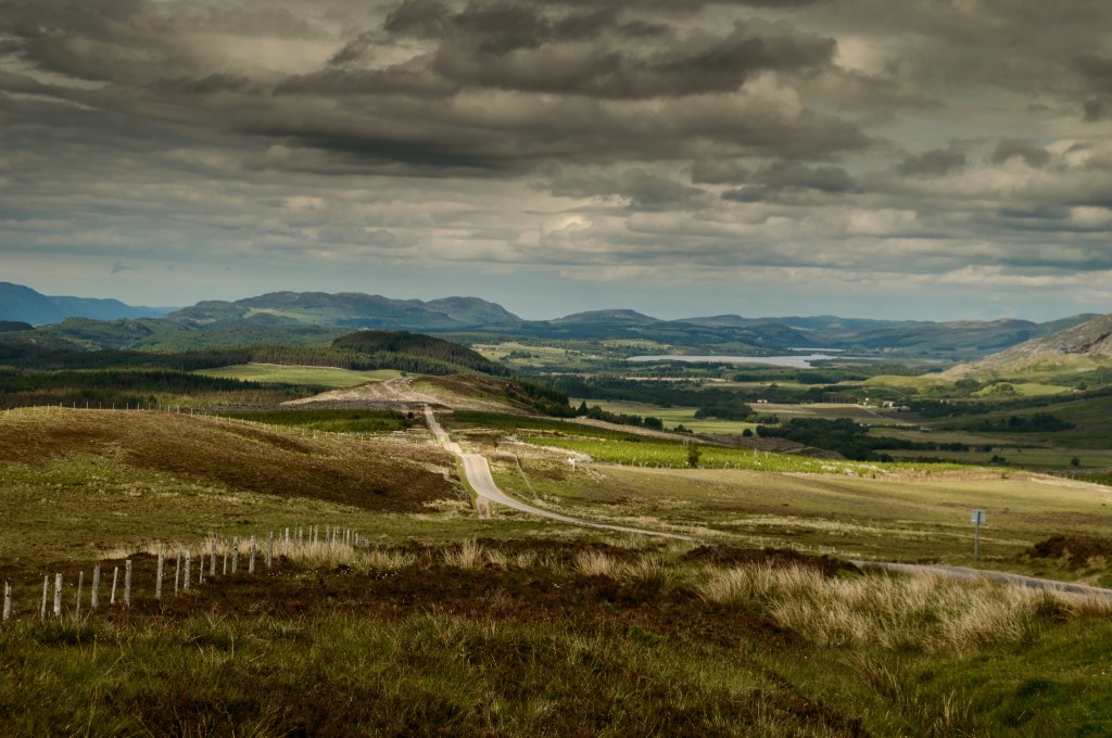
We decided on only a couple of details for the trip before we arrived – the start-point, whether we’d walk on the north or south shores of each of the lochs, and the end-point. Every other decision could be made when we came to it. Find the entire mapped route here: plotaroute.com/route/633013
South of Loch Ness
Day One – Inverness to Dores
The first half of our Scottish adventure required us to tackle the length of Loch Ness and reach the midpoint of our journey at Fort Augustus. A haven for those travelling the length of the Caledonian Canal, and the gateway to Loch Oich and Loch Lochy. I think for now it was probably wiser to just focus on getting halfway and we could focus on those two later. We woke early in London and left on the first train out of town to Luton Airport. It was quite clear that we were different to the other travellers at the airport that morning – we lacked the stag-do team t-shirts or sandals and sun-hats, so our walking boots and massive rucksacks stuffed with survival precautions gained us a few side-glances.
After arriving at the tiny Inverness airport, we took the shuttle bus to Inverness town centre to pick up some supplies – namely the flavoured packets of rice and pasta that would form the bulk of our diet for the next week. We then made our way to the start point of our hike, The Castle Tavern, for our first Scottish pint – and the only real meal we would be seeing for the next few days.
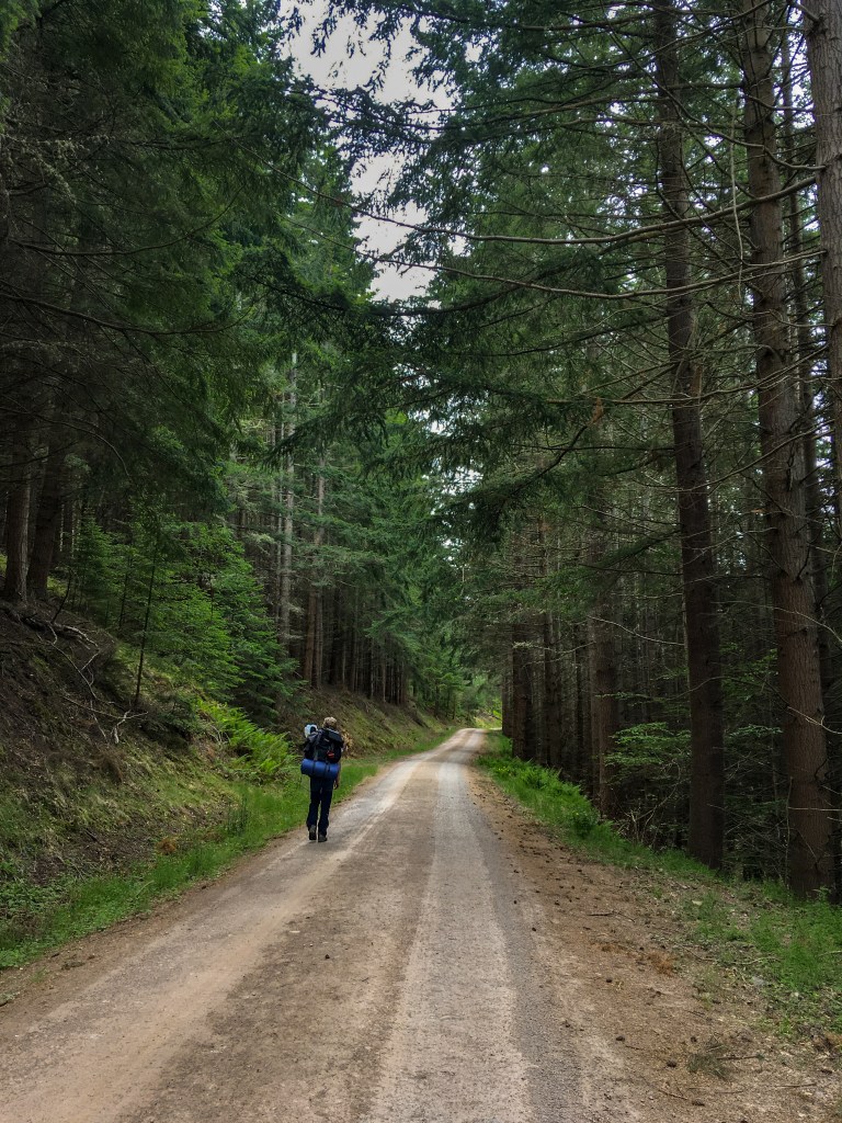
Setting off with the River Ness on our right-hand side, we followed the water upstream through the small villages on the road, before heading deep into the woodland and to the riverside. It was clear we were already getting closer to the wild Scotland I had been hoping for as we stopped to pick up a blue tit chick that had fallen from its nest and spotted an American mink, an alien species to the UK, chasing ducks on the far bank. Although not technically native, it was exciting to witness any small mammal in the wild.
Whilst stopping for a rest at a small fisherman’s hut at a particularly pretty section of the river, I was slightly tempted to have a cast or two before I noticed the members-only signs and thought better of receiving a fine. Setting off again we rounded the corner of the river and entered a dense woodland that led us to the shore of our first loch, Loch Dochfour. In all honesty, it was a rather underwhelming body of water and within no time we had reached the Bona Lighthouse that marked its most southerly point and the end of the loch. The route then turned away from the water’s edge and as we crested the hill we caught a fleeting glance of Loch Ness in the distance before heading over the top, towards the main road and the small village of Dores.

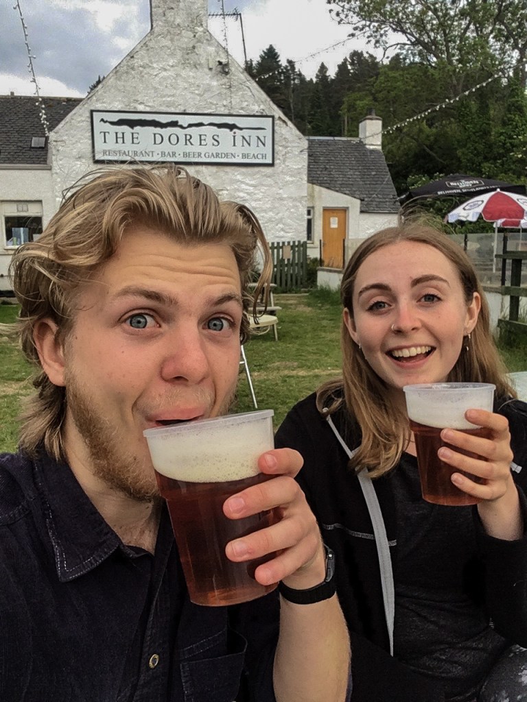
It was here that we would spend our first night in the tent on the banks of Loch Ness and after a long first hike, it was also home to the second pub of the day for us – The Dores Inn. Grabbing a couple of beers from inside, we took seats in the beer garden overlooking Loch Ness and the shingle beach stretching out in front of us. One day of hiking down and we were feeling tired but great, having made good time today things were certainly looking good.
As dusk approached, we soon realised that we had a tent to set up and food to cook. With no campsites planned, we were on the lookout for the flattest, quietest and greenest square of land. What we settled on was none of the above. Night one was an uncomfortable sleep on the rocky shore of Loch Ness beside General Wade’s Military Road (GWMR) – a track we were going to know very well by the end of this trip.
Day Two – Dores to Inverfarigaig
Nothing helps you forget the indents in your back from last nights beach mattress like a hard days hiking. Waking up on the shore of Loch Ness was something I had been looking forward to for months. The mist hung low over the water, and as it was still only 5:30 AM the sky was regaining its colour through reds and oranges before settling on deep, eerie blue.

Today was a day of two halves. We took GWMR passing through the forest and snaking up and down the hillside, occasionally down to almost the waters edge. The road stretched out ahead of us and we kept on plodding straight through until lunch, at which point we found an outcrop from which I could fish and somewhere for Caitlin to paint. I caught nothing and Caitlin painted me doing so. We cooked some rice and ate quickly, with a drive to continue and our legs aching to keep going.
Taking a diversion off the flatter and more direct path, we headed uphill and climbed up to the ridge that follows the south side of the loch. The terrain varied considerably, we walked through dense woodland, sparse moorland and the barren, ominous landscape left behind from recent logging operations. A few hours of climbing and hiking along the top of the ridge later, and we began thinking about the evening and our campsite for the night. We knew one thing for sure – tonight we would not sleep on rocks and roots again. Looking at the map we found the small village of Inverfarigaig not too far away and, with the hope of finding somewhere to refill our water, we began the final hours decent.
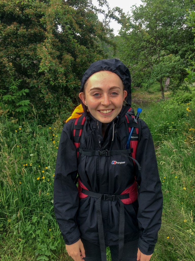
Only 45 minutes into our ‘final hour’ of hiking, the path disappeared in front of us with no obvious route forwards. We followed the most direct route towards Inverfarigaig, only to find ourselves at the top of not one, not two, but three cliffs. Surrounded on all sides, I decided the best option, of course, was to see if we could scramble down the ‘least steep’ cliff. Caitlin let me know what she thought of this idea after watching me slowly struggle down on the loose shingle and we sensibly turned back towards the path we had just left and retraced our steps. After drawing on our Brownie and Scout knowledge, we found the route of most gradual incline and worked our way through bog and brush to the bottom of the valley, with only one stream left to cross before the road into the village. Now, this had already been a hard day on our bodies, but this final obstacle turned out to be the last straw for Caitlin’s left leg as she stepped onto a fallen tree and straight through it up to her neck in nettles and stream water.
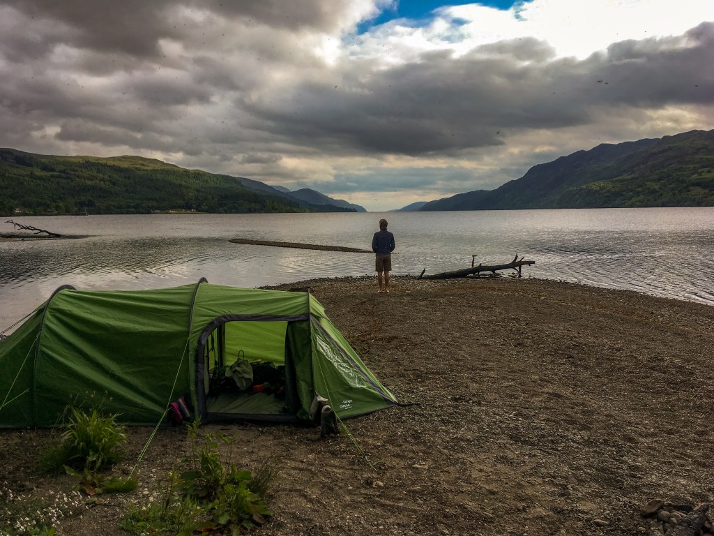
Climbing out with motivation in tatters, we wiped away the tears and most of the mud before following the road down into the village where we fetched water from a public restroom and scoured the area for open land to pitch our well-deserved bed. Turns out this part of Scotland isn’t known for its flat land and we struggled to find anywhere, other than private gardens, that suited our needs. Tensions were starting to get high and we needed to get the tent set up and get food inside us, preferably on flat land. We decided to head down to the shore again and scout out another spot by the water, as a last resort. After the turmoil of the day, our luck was about to change as we stumbled upon the most unique camping spot next to Loch Ness – the decommissioned Inverfarigaig Thomas Telford pier. Time to eat and sleep – day three was going to be another big one.

Day three – Inverfarigaig to Fort Augustus
Time for a long day. We were now half-way across Loch Ness and unable to see either end of the loch from our position on the water. Today’s aim: to make it to Fort Augustus and reward ourselves with a warm meal and a cold pint. But first, I had some fishing to do. One thing I had wanted to do in Scotland was to catch and cook my own fish on my way from loch to loch. All three lochs contained trout and I was set on catching at least one fish from each, whether it was sizeable enough to eat was another matter. Having failed on days one and two, today was my third and potentially final attempt. Stood on the jetty, I now had a vantage point protruding out above the deeper water. I would love to talk about fishing in depth here, but all that needs to be said now is that I caught my first trout of the holiday and it was an all-encompassing experience.

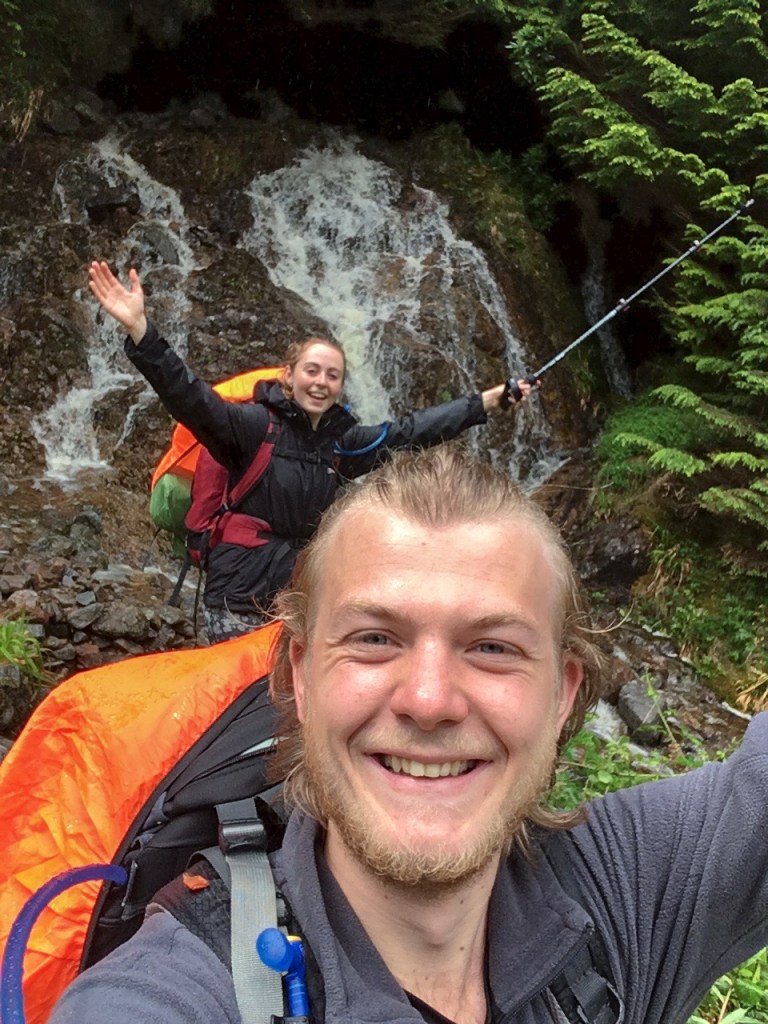
Post-fish, we set off, once again following our old friend GWMR. This took us back into the hills and into Foyers and it’s famous waterfall. Unfortunately, there was no time to stop here for long, we popped into the shop to grab a drink and began to walk down through the woods to the waterfalls before turning back uphill, realising we would have to climb back up, in favour of more miles and therefore, an earlier lunch. Continuing on our way, we pushed on further upstream of the River Foyers occasionally stopping to take in the beautiful cascading waterfalls that seemed to be situated every hundred feet, who needs the one in town anyway. Turning away from the River Foyers we made our way to our lunch stop in Whitebridge above the River Fechlin.
Sitting on top of the namesake of the village, we cooked yet another pan of indescribable pasta/rice and nursed what were now becoming slightly sore feet, while listening to the river running beneath us. Socks, shoes and a couple of blister plasters back on, as was becoming a tradition at every lunch stop, we set off yet again. With the sun above our heads and the road stretching out ahead of us we headed back uphill again on an incredibly straight section towards the Suidhe viewpoint. Throughout the day we were passed by numerous well-wishers on bikes and in cars who shouted encouragement from their saddles and seats. On this long stretch of the gradual climb we were passed by a number of these well-wishers and as we reached the peak of the climb we were welcomed by a group of cyclists who had passed us on the climb only half a mile before.
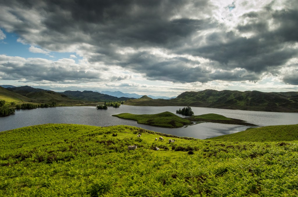
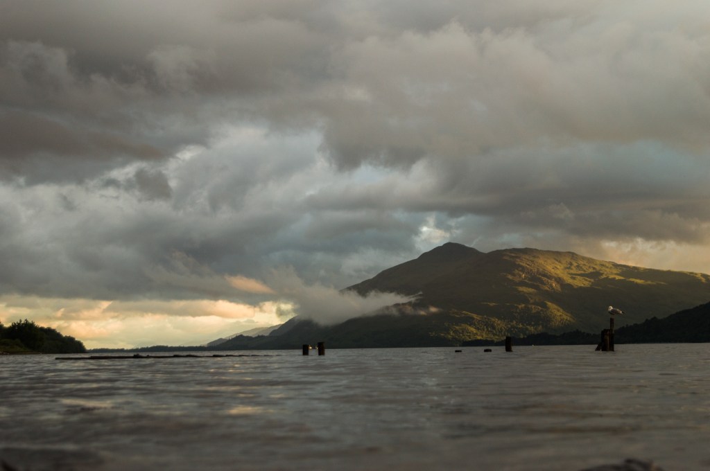
The view from here was incredible – potentially the best of the entire trip. A full 360º panorama and a view of up to 7 lochs, depending on the conditions, sat beneath striking rocky hilltops. In the immediate distance lay the small glacial Loch Tarff, glowing ethereally as if to invite you into its depths. We hiked along the small ridge leading towards the start of our descent, passing by a flock of hardy sheep, before heading downhill to Loch Tarff. From here it was simple and we followed the road snaking down towards Fort Augustus and the first pub we had seen in a couple of days.
Step-by-step, the longest day of hiking was coming to an end. And as Loch Ness and Fort Augustus came into view with only a few miles to go, Caitlin and I burst into tears at the sight. Some situations you can’t predict or prepare for, and we had no idea how emotional seeing the halfway-point of our trek was going to be. Almost skipping with joy downhill, we sped through the final miles of road before entering the town of Fort Augustus and heading straight to the pub for something to eat and drink. After trying one pub just to find them finishing service, we stopped outside The Loch Inn situated beside the canal and Caitlin popped in to see if there were any tables going, unlikely as people were spilling onto the street. She came out with a huge smile across her face and beckoned me into the pub.
I mentioned earlier that many others travelling along GWMR had wished us luck on our way or stopped to chat with us about our journey. They must have all got the memo that we were stopping here today, as when we entered the pub we were welcomed by cheers and congratulations for making it. A couple stepped up from their table and said they had cycled past us earlier that day, and told us that the table was ours. We spent the evening in fantastic company, sharing stories with other guests and eating and drinking to our heart’s content. After a couple hours, Caitlin started to make herself more comfortable and at one point I am sure I saw her nod off, only to wake herself up as her head fell slowly to her shoulders.
As the night came to a close, I got chatting to the bar staff about the local area and as they pulled our final pints of the night they suggested a camping spot that we should try on the shore of the loch. With the memory of stones from our first night still at the forefront of our minds, we took their advice with some caution and followed their directions past a water treatment plant and into more dark and dingy woodland. Stepping out from the cover, we found ourselves on a small beach with potentially the most scenic backdrop in the whole of Scotland. Time to sleep and prepare to leave Loch Ness for good.
South of Loch Oich
Day four – Fort Augustus to Laggan Lochs
We were finally getting used to this. Waking up to beautiful scenery, making a cup of coffee and sitting beside arguably the most mythical body of water on Earth. Another day, another hike, and today we were heading away from Loch Ness to the wonders that Loch Oich had to hold. The route today took a slightly different course as we were to follow one of the straighter sections of the Caledonian Canal from Fort Augustus to Loch Oich. Designed and built by our old friend Thomas Telford, the canal links Inverness, Loch Dochfour, Loch Ness, Fort Augustus, Loch Oich, Loch Lochy, and Fort William allowing the freedom of transport from one side of Scotland to the other. Vast swathes of the route are navigable lochs, however, a significant length of the route is man-made and is equally as impressive.
We began our journey passing The Loch Inn once more and climbing up the staircase of locks in the centre of town to the towpath. Far more leisurely hiking on the flat path meant we moved quickly through the valley and chatted away idly to the many holidaymakers on the boats passing by. One group, in particular, we recognised from the pub last night and we raced them for an hour or so from lock to lock. Turning down their offer of a rest and a cup of tea, we left them around half-way to Loch Oich and hiked on at a fair pace. Upon reaching Loch Oich we got chatting to another couple who told us about the Invergarry to Fort Augustus railway that once skirted along the shoreline we were walking on. Relics of the railway soon were appearing in front of us, from the tunnels we passed through to the remnants of bridges over the many streams that flow into the loch. As lunchtime approached, there was a sudden change in the weather. The wind was beginning to pick up and clouds were replacing the previously clear blue skies we had become used to seeing. We took shelter under a tree on the shore of the loch as the first rains came, and set up the fishing rod in preparation for a lunch-time catch.
After 25 minutes of off and on rain, our luck changed as something deep in the lake decided my spinner was worth the chase and tugged back at the line. A couple of minutes later and the snarling jaw of a Highland pike broke the surface. One thing you notice fishing across the UK in different environments is the diversity a single species can show. The pike I am used to catching in the south of England are pale, striped and often slightly speckled. This pike was quite the contrary. It was much darker in colour, with shorter stripes – perfectly suited to the deeper and murkier depths of Loch Oich. After releasing the fish we sat down to prepare our fish-free meal of rice once more before something caught the corner of my eye. A darker wave in the middle of the water, unlike the others, which disappeared again in a blink. Then, the wave reappeared once more, further out in the water, this time giving me a glimpse of the head of an otter before it dived down deep into the loch, not to be seen again. Caitlin still can’t believe she missed seeing an otter in the wild.
We ate our rice and then, as a storm began to make itself known overhead, we began again on the old railway line towards the other end of the loch. Pushed on by the imposing storm we made it to the end of Loch Oich in little time, passing the now defunct, but partially rebuilt, Invergarry station and back to the towpath of the Caledonian Canal. The rain was coming in thick and fast now and, with only the evergreen trees above our heads offering partial protection from the rain, we were desperate for the weather to pass us by. One hour later (and 100% damper) we began to notice signs of civilisation once again, with boats moored on either side of the canal and the valley widening slightly ahead. What we needed now, was a sit-down and a pint; but with the map showing only a tiny cluster of buildings and no characteristic holy-grail pub symbol for our much-needed drink, our hopes were not high. As Loch Lochy began to appear on the horizon, the outline of one particular ship caught our attention. A giant dutch barge, painted red, white and blue, sat quietly atop the water. A sign outside the door: “Open”, and in big letters across the side were the words “The Eagle Barge Inn on the Water”.
If I could only recommend one pub from our adventure for you to visit, it would be here. This barge has been converted to the ultimate secret Scottish gem, a hidden treasure in the rough of the Highlands, a solace for the weary hiker and the exact cure for Caitlin and I on this day. Walking down into the boat we were met with relics of shipwrecks, books on Scottish wildlife, a bar serving 4 local cask ales and over 100 whiskeys to peruse. The barman of the night was a young Floridian seeking a different way of life and the patrons were an eclectic mix of locals and tourists all hiding, like us, from the storm. We took our seats, ordered two dark pints of real ale and dried ourselves off. The bar had the decor of an amalgamation of front rooms from the last 100 years, with a log burning stove, armchairs, stools, paintings and rugs. Let’s just say it was cosy – and exactly what we needed. After an hour or so we were deep in conversation with a number of the other visitors of the night. Another hour and we were sitting together sharing stories of Scotland with a whiskey in hand. Go to this boat.

At this time of year in Scotland, the sun doesn’t ever really set, it feels like evening never ceases and before you know it morning has already reared its head. As we left the barge it was reaching the darker stages of the evening and with a storm blowing overhead we still needed to find a pitch for the tent and cook our food. Now I’m not sure whether it was the hours spent drinking with our new friends or the tiredness catching up with us, but the first patch of flat land we found we settled upon. A perfect tent-sized clearing in the woods at the edge of the loch. I know what you’re thinking, another loch-side campsite for me to complain about. As I struggled to ensure the tent wouldn’t blow away in the night by attaching guide-ropes to just about anything solid, Caitlin began to heat up our camping stove inside the tent without burning down our shelter.
This is the night I learned more Entomology than in the 23 years previous. We had been warned of the midges on numerous occasions whilst planning our trip and we had both experienced our fair share of insect bites on previous trips. Up until this point we had seen no sign of Scotland’s infamous pest. But as the storm gave life to the earth, thousands upon thousands of eggs hatched beneath our feet, thirsty for blood. After battling the winds of Storm Hector (we knew it had a name, thanks to a new friend on the barge) I fought the swarm from below before cowering in surrender inside the tent. Eating quickly, so not to entice the midges with the smell of food, we hit the hay and listened to the storm battering the trees overhead.
On other days this is where the entry stops. But this night was unlike any other. The trees above our heads cracked as they collided, sometimes sending needles rattling down to the thin polyester roof above our faces. The sound of branches falling in the clearings around us kept us close together, and as the storm raged around us we felt very small in a very big, wild world. Finally, there was a gradual settling of the wind and a relative calm in which we both managed to close our eyes for long enough to drift asleep.
North of Loch Lochy
Day five – Laggan Lochs to Gairlochy
When the worst of the storm had passed, we awoke to find the tent surrounded by needles and twigs. We stepped out into a damper and more traditional Scotland than before with pounding headaches and empty stomachs. After packing away our damp tent, we walked back towards the canal and the boat that provided the refuge we so dearly needed the night before.
Closed.
Caitlin was not amused. The thought of someone else preparing her breakfast today was the main motivation for leaving the dry shelter of the tent. We turned our backs to the boat and headed towards a small hut on the towpath. From the depths of her bag, Caitlin pulled out a key attached to a foam cube and opened the door. This unremarkable building was one of several situated along the length of the Caledonian Canal, built to provide amenities to the many boat-folk who passed through the waterway.
Fortunately for Caitlin, behind the door lay another refuge for her soul – a fully functioning shower. After four full-on days of hiking, we were in need of a good clean and wasted no time in soaping up and refreshing ourselves for what looked like a grey and gritty day on the road. Scrubbed clean and with our teeth minty-fresh, we stepped back into the real world and faced the day ahead of us. The third loch of the trio lay in full moody splendour ahead of us and, for the first time, we were to take the north shore route and along the official Great Glen Way. As I began to pack up my bag and prepared to load my shoulders up for another day, Caitlin decided to take one last look at the Eagle Barge to check if they had changed their minds about making her something warm to eat.
Open.
Scrapping any immediate plans to walk, we rushed down into the cabin towards coffee and someone else cooking our food. Melting into a large leather sofa we watched as new and old faces came and went while we learned more about the flora and fauna we were likely to spot around Loch Lochy from a number of the books lining the shelves. An hour or so passed us by, breakfast became lunch and coffee became chilli con carne and a sandwich and soup – typically Scottish meals to prepare us for the inevitable trek we were pushing later into the day. As we finished our meals, the sky began to clear once more and the bright blue we had been so used to seeing over the first few days became a sign that it was time to leave our temporary floating home.
We were back on the road under a new sky, with the smell of pine and rain in the air. The woods here felt different to the ones we had passed through before – they were older, full of cascading waterfalls and small fairy dells. For the vast majority of our trip we were alone in the landscape when walking, but now we were passing others who had put a home on their backs and headed for the hills. The path rose steadily, further into the woods, and we began to lose sight of the loch below. With my aim of catching a fish from each loch, I was happy to see the path slope down again closer to the water’s edge and a chance at fulfilling my quota. We climbed down from the path, hastily put the rod together and began fishing. The wind had really picked up now and waves battered the beach endlessly. Casting with the wind I finally managed to get into the last piece of my collection for the trip. After mere seconds out of the water another brown trout was unhooked and returned to the murky depths, and we were back onto the track again.
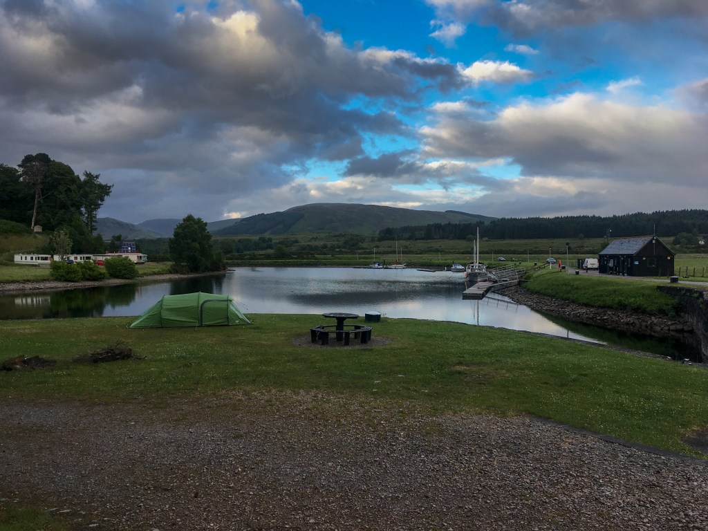
It was around here that we began to feel that we were truly on the final stretch of our hike. After spending a number of days in these shoes and approaching the end of Loch Lochy, we were excited at the prospect of getting a glimpse of Ben Nevis peeking out from behind the clouds. We reached Gairlochy at the end of Loch Lochy in good time and settled in a clearing designated for those travelling the Great Glen Way on foot. The rain fell lightly now and we decided to make the most of our surroundings by lighting a fire in the fire pit provided. We had learned by this point that changes between rainy and sunny weather signalled the hatch of midges, this was one of those times. Caitlin rushed back to the safety of the tent as I began frantically trying to set damp kindling alight. After 10 minutes of repeated failures, a healthy fire began to smoke out the midges, validating my efforts and providing some space to bring out the cooking stuff. It was a good job we decided to make a fire that night, as a couple of minutes into heating our pasta we ran dry on the fuel canister we had brought and quickly transferred to a makeshift stove in the fire pit. Exhausted and covered in midge bites, we retired to our bed and listened to the gentle lapping of water against the lock and the wind on the masts of the boats stationed in the small harbour nearby.
Day six – Gairlochy to Fort William
It was time to finish this. We woke up feeling exulted and ready to reach the final destination of our trip. A day ahead of our planned arrival time and with confidence in the ability of our legs, we set off along the towpath of the canal with a spring in our step. However, the weather was yet again working against us and we battered through what felt like all four seasons within a couple of hours of leaving the campsite. Taking shelter under a large oak tree, we watched as a tornado of swallows swarmed around us, catching the hatch of flies awoken by the rains. We stood in awe as they darted within inches of our faces and for a moment forgot about the rain falling heavy all around us.
When the rains abated once more, we continued along the path for a final couple of miles towards the famous landmark, Neptune’s Staircase, at Banavie. Not far to go now at all. Taking the road towards Fort William we began to recognise the distance we had come so far and the short walk we had left before reaching our final destination. Taking a bridge over the River Lochy we followed the route of the West Highland Railway Line into Fort William. It felt like every day something truly magical had happened to us – finding the perfect camping spot in the middle of Loch Ness, finding refuge inside a floating pub and the endless wildlife that we were exposed to as we walked. Today our fix of magic was the actual magical Jacobite steam train (also known as the Hogwarts Express) rushing past us, reducing Caitlin to tears.
Taking our final steps into Fort William, we crossed the River Nevis, walked through the town centre, and reached our final destination at the water’s edge. I’d like to say this was hugely emotional moment but in all fairness, what we both needed was a good meal and a pint before we could take it all in; so that’s exactly what we did.
We headed straight to the Garrison West which we had passed on the way in, lay down our bags and headed straight to the bar to celebrate our achievements of the week. After consuming a number of drinks whilst we waited for the chefs to arrive for the evening meal, we headed through to the dining room where a number of significantly cleaner and more appropriately dressed people stared as we traipsed in. A hearty meal of vegetarian haggis, mac and cheese, and other carby delights down us; then it was time to head to tonight’s campsite, a little place called AirBnB. We deserved it.
Day seven – Fort William
There is a lot to be said about planning in advance, but when this damp Saturday morning came I was not thrilled with the decisions made by my earlier self. We had agreed that if we made it to Fort William before Saturday morning we would head out early and take part in the Fort William Parkrun. A 5km jog through the lower reaches of Ben Nevis, taking in the forest and the streams and rivers flowing from the mountain nearby. We were here though, and after a rather costly taxi journey to the meeting point at the Nevis Range Visitor Centre (as no buses operate early enough to get you to the run on time) we stood with around 50 other runners from across the world ready to tackle the route.
As always an eclectic mix of people had turned out, most of them tourists looking to get their running fix just like us. Even through the air thick of rain and insects, it was incredible to be able to run in such a beautiful setting. We managed to get around in a respectable time and, covered head to toe in midges, we took up residence in the cafe and relaxed with two big mugs of coffee. We watched as hundreds of kids descended on the lower slopes of the mountain, clad in full body protection and on bikes built for people with longer limbs. It felt odd to be sat around with no real plan for the day.

We finished our drinks and made our way to the now operational bus stop, and found ourselves chatting to two of the other runners from earlier who had also come up from London. After a short bus ride with our new-found friends, we were back in town and back at the flat. After a quick shower, and breakfast with our host (who kindly let us leave our bags at his place as long as we wanted), we headed back out into town to see what Fort William had to offer for two travellers. We took the path down to the shore of Loch Linnhe and to the old fort on the seafront before heading into the town centre for shopping. With little to do, we wandered aimlessly in and out of the shops and I picked up some fishing tackle before we settled down for something to eat and drink in the local Wetherspoons to plan the rest of the day.
For the entire journey, our families had provided support in the form of the occasional pint or pub meal bought to help get by after a long day on the road. One thing neither of were expecting was to have a hotel on the shore of the sea loch booked and ready for our arrival on Saturday night. Goodbye tent, hello massive comfortable hotel bed, incredible food and bar with a view of the sun setting over the sea loch. You can probably tell why we left the Wetherspoons, collected our gear from the AirBnB, thanked our host, and made the two-mile hike to our new home for the weekend, The Clan MacDuff Hotel.
We checked in to the hotel and were led to our room with a view; as soon as the door closed behind us, we dumped our bags on the floor and collapsed into the massive bed. We could have stayed here and not moved until the morning, but it was 4pm and we had more of Scotland to explore. After a few more minutes in bed, we grabbed the fishing gear and headed out to the loch to see if we could catch something to cook on the beach. We had heard that shoals of mackerel often fed in the bay and could be caught from the car park in town, as well as the chance to catch a sea trout if we got particularly lucky. It’s a good job we didn’t get lucky and have to cook there. The longer we stayed on the beach the more the midges arrived – first as a mild annoyance, but soon building into an audible black cloud that had chosen us for their dinner. It was obviously their beach, so we left them to it and headed back indoors.
Sitting down at a table by the window, we ordered drinks and sunk into our seats. It was impossible for anyone to tell that we had just hiked here from the other side of the country now that we were clean and properly clothed. But we had, and this was our reward. Drinking Scottish beer and Scottish gin, we ate haggis, salmon, and (perhaps not-so-Scottish) pasta, before treating ourselves to some dessert. Full of food and very happy to not have anything to tidy away tonight, we retreated to our room for a quick change before heading back down for a drink in the bar. Collapsing into massive sofas we talked about our journey over a couple of whiskies and thought ahead to the literal mountain we would be facing tomorrow. As Ben Nevis is climbed by around 100,000 people every year, we were optimistic about the hike, especially with so many miles under our belts already this week. “It’ll be a breeze” we agreed as we left the comfort of the sofas for the comfort of our bed.
Day eight – Ben Nevis
With a big day ahead of us we ate breakfast early and fueled ourselves up for the day with full Scottish and veggie Scottish breakfasts, haggis included. Not wanting to do half a job, we decided (read: I decided) to walk from our hotel to the mountain, rather than taking a bus or taxi to the base station. With a considerably smaller rucksack on than either of us were used to, we set off along the coastal road on our mission to the highest point on the British Isles. I have been hounded relentlessly about the following fact, but, for the entire trip so far, I had been without a raincoat. Now, with a mountain to conquer in the wake of a storm, it was a good job Caitlin had forced me into a charity shop to grab something that would keep me dry for the day. Now fully equipped and less smug about my personal achievement of keeping dry in spite of the weather, we made our way to the Ben Nevis visitor centre on the banks of the beautiful River Nevis to prepare for the climb ahead.
Taking the bridge over the water we began hiking along the famous pony track to the top of the British Isles. This was formally known as the tourist route but was upgraded so as not to mislead any potential hikers about its difficulty. At the lower reaches, the path creeps along the sides of fields and over small streams flowing down the mountainside with stones set into the ground, making for easy walking. There were a lot of people tackling the mountain today even though the weather forecast was pretty poor and there was little-to-no hope of seeing anything from the summit.
We left the lower section of the hike and turned the corner up the solid stone path that skirted the edge of an almost sheer cliff towards Lochan Meall An t-Suidhe. The Half Way Lochan is a strange sight to behold and one of Ben Nevis’s most photogenic sites sitting in the valley between two peaks. We walked past a scout group who were setting up camp on the banks of the lochan for the night. With the wind blasting through the valley in the middle of the day, we were happy to have a warm bed to head back to. Here the terrain changed from the bushes and grasses of the lower steep hillsides to a boggy plateau, before changing once again to the more classic mountain scree on the final ascent.
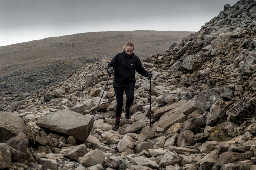
We took a rest next to a waterfall for a snack and drink, watching the clouds forming and clearing around us, giving fleeting glimpses of the valley below. It was approaching 2 o’clock so we only had an hour of the warmer weather left before things started to cool again. Back into our stride, we took off up the zig-zagging path climbing into the clouds and over smaller and smaller streams. We should have waved goodbye to the occasional views we had as from the plateau onwards, visibility deteriorated considerably. As water in the clouds started condensing and refreezing on my beard, we were taken aback when we stepped onto what looked like the top of a cloud. Snow, in mid-June. A 50m ski slope stood in the way of the path and we watched countless hikers slip and slide as they tried to traverse it.
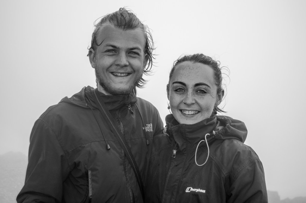
Scrambling across the snow we made it up the slope in one piece and now with only half a mile of straight path left to the summit. The fog was intensely cold now and we approached the cluster of buildings that at one point had housed the highest hotel in the British Isles. Climbing to the trig point, we quickly had our photo taken by some other hikers before stepping down to find them with a beer in hand. Why didn’t we think of that? I think Caitlin must have been quite vocal about her disappointment in us as seconds later I spotted Caitlin talking to them and being offered some beer as well. I missed out. With absolutely no visibility of anything other than the clouds we stood in and our feet, we started on our descent.
It is easy to forget that going downhill does not mean the hiking is any easier. With an entirely different muscle group in play and icy and damp rocks to navigate, it only made things harder. We scrambled down to the snow patch where I proceeded to skid past the hikers taking the downslope much more cautiously, followed by Caitlin shaking her head at my childish enjoyment of a slippy surface. Fewer hikers were making their way to the summit at this hour and as we dropped below the cloud level I stopped to take a couple of photos at the point that we now knew was highest clear view on the mountain that day. We then sped off down-hill past the waterfalls and loch before taking a different route down to the River Nevis and hostel. This route was considerably steeper and was built from cobbled stone that had obviously undergone years of battering from the relentless footfall of hikers like us. This made for far slower progress.
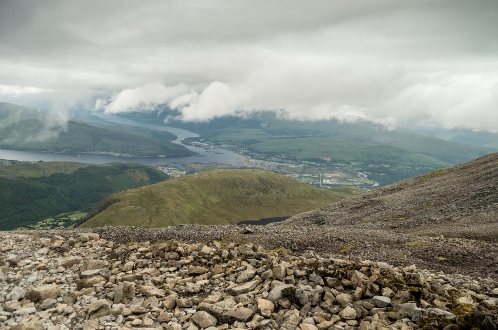
As we reached the bottom of the mountain again, we followed the river back downstream towards our start point at the visitor centre, passing pristine gravel bars and huge patches of green underwater foliage. We meandered along the river bank and called home to give updates on our achievements with our bucket-list all ticked off for the trip. Crossing back over the bridge again, we retraced our steps along the road and towards Fort William before making the decision to take a different route skirting the pleasantly named Cow Hill. From here we had a great view over the town, Loch Linnhe and the narrows that linked it to Loch Eil to the north. We weren’t alone in enjoying this great view, as we came across another couple of hikers that had set up their tent on the viewpoint for the night. Despite this, we still didn’t fancy getting back into ours today and carried on towards our big comfy bed. The route home took us past our AirBnB and back down to the loch’s edge, with only the home straight to go.
We really didn’t take the easy route on this trip. We had now completed 125km of hiking and 3500 meters of altitude through storms and brilliant sun and yet we still felt like our adventure could only go on. It was almost 7pm and I wanted one last attempt at catching something from the loch, so temptingly near. It took around 5 minutes for the midges to recognise me and we quickly packed up the fishing gear to head back, defeated. Before we left I took the opportunity to wade into the loch to take a few photos of the sunset as it shod on the hillsides in the distance. I managed a couple of shots before the midges hurried me on, back to the hotel and back to food.
We took our seats by the window in the restaurant and tucked into another delicious meal with yet another proper dark Scottish pint. We were set to leave in the morning so we finished our meals quickly and headed back upstairs to pack the bags with our gear, now spread across every inch of the hotel room floor. After some serious balancing of tents and tying bits and bobs back onto our bags, we were ready for the morning. A long bath later, and we climbed into bed and within the blink of an eye (albeit a sustained blink) we were out for the night.
Day nine – Fort William to Inverness
The day had finally come for us to make the journey back south and out of Scotland. Packing our things away early, we set off to try and catch the early bus back to Inverness, allowing us some time to see a little more of the town we had so hurridly left only a few days ago. We bought bus tickets on the walk over to the bus station and arrived just as it pulled in. Taking seats beside the window on the right side, we prepared for the road on the north side of Loch Ness. I have to admit, driving back through the Great Glen and seeing some of the places we had walked through within such a short time was quite underwhelming. In a little over two hours, we were back where we started and this time with nowhere to go and nothing planned for the rest of the day.
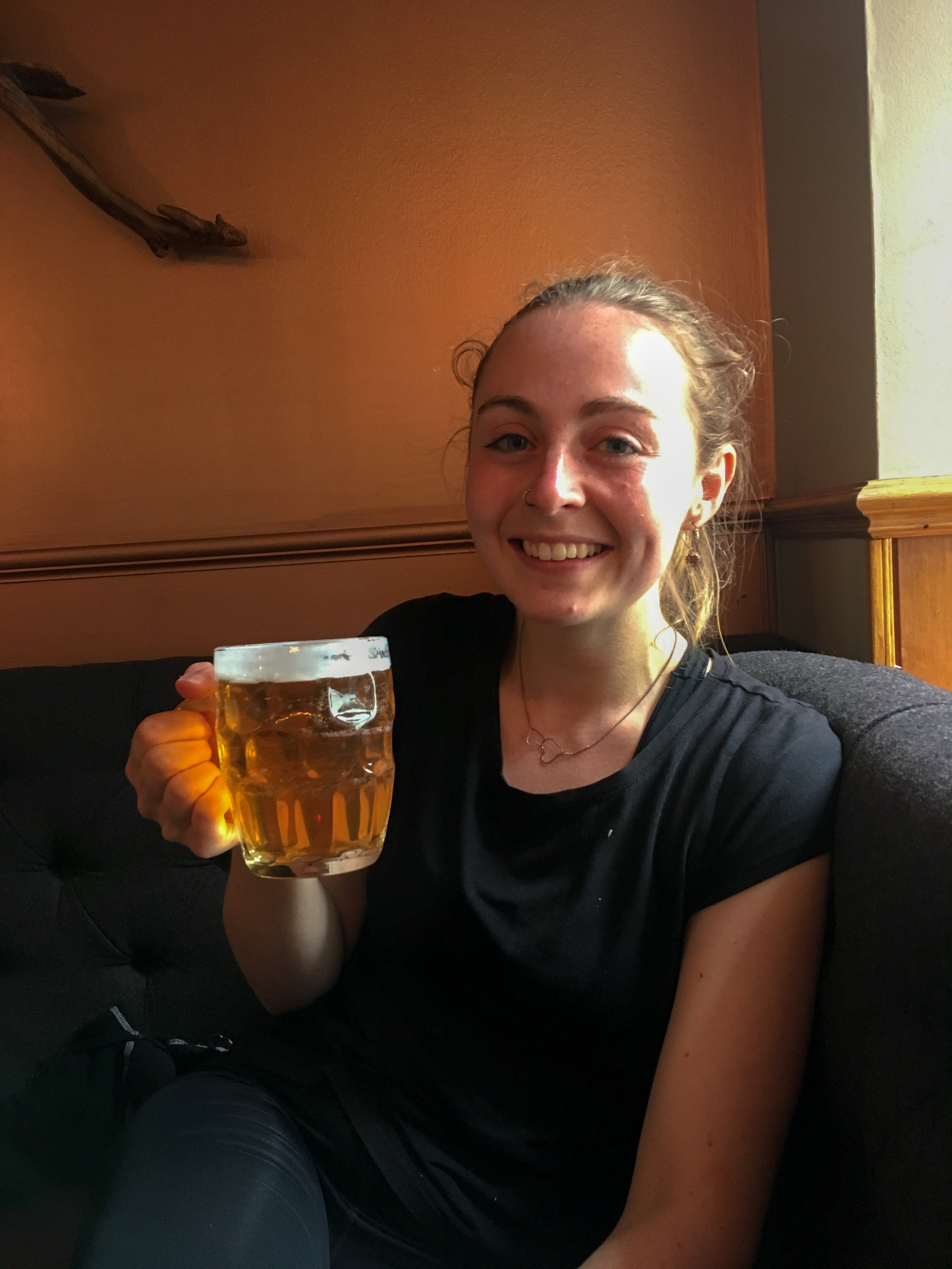
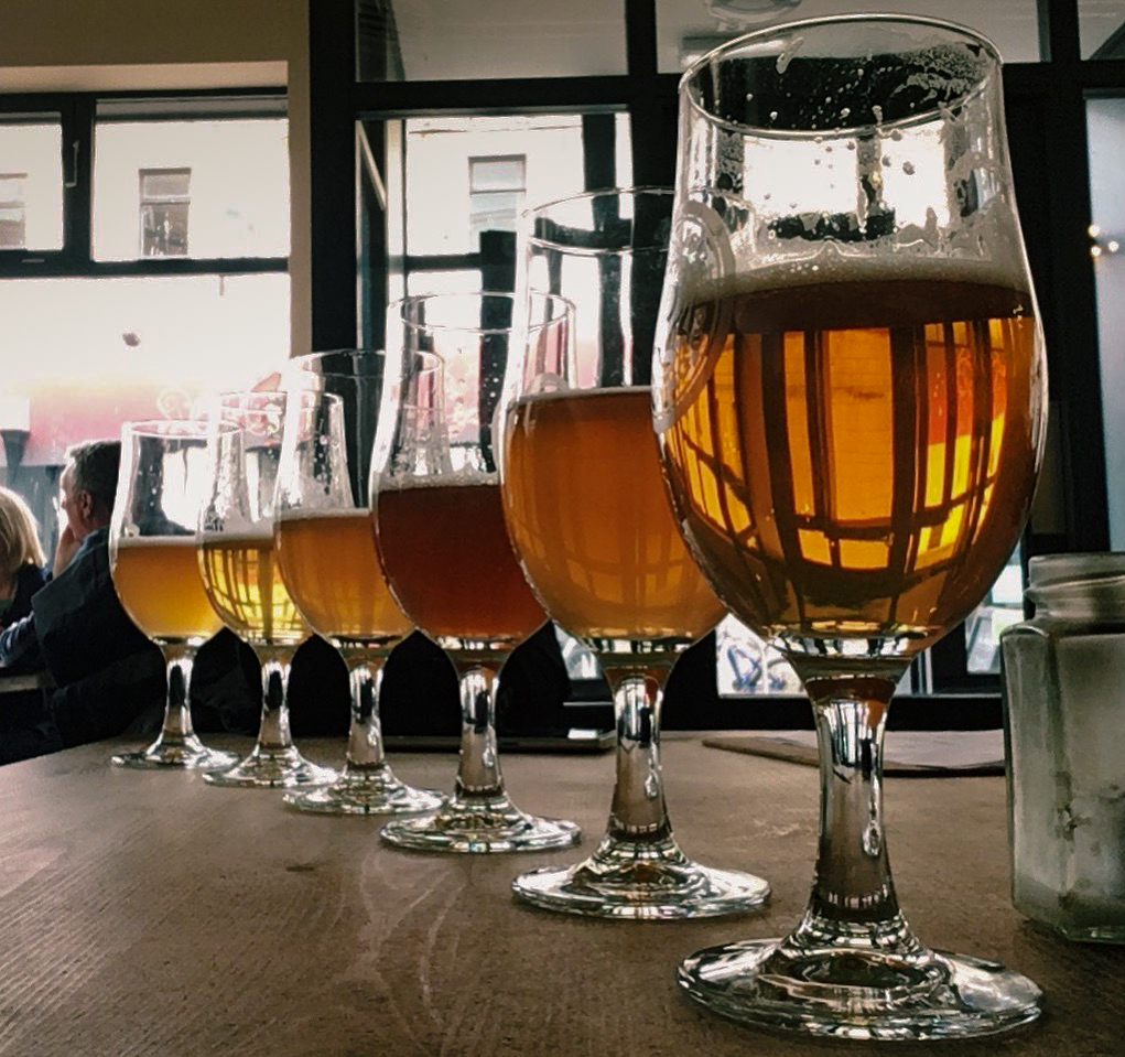
After having a quick walk around the town we settled on the idea of grabbing some food and a drink to waste the day away with. Unbeknownst to us, we were now in the hometown of a brewery whose beer we had been drinking the whole trip, so when we walked past the doors of Black Isle Brewery’s tap room we had the decision made for us. An incredible bar with 24 beers all laid out on taps across the back wall, we dumped our stuff at a table and made our way to the bar. With such a selection on offer, it would be rude not to pick 6 beers to start with as a tasting flight and got a couple of pizzas to go with them whilst we talked about just what we had achieved.
A few rounds later, and still far too soon, our time in Scotland was up. Slowly, we made our way to the bus station and hopped aboard the shuttle to the airport. Back in the airport, we passed through security in a couple of minutes and made our way to the bar to watch the England football match. Things were starting to feel a lot less Scottish already, even though we were only feet from the Scotland side of the airport. The tannoy system echoed into life, our gate was called out, and our adventure was about to end. Leaving the bar we joined the queue to board the plane back to Luton and slowly we plodded back towards normal life. We were only feet away from boarding and the tannoy kicked back into life: “would the owner of the pink folder left at the bar please come and collect it”. Caitlin raced back to reclaim her passport and boarding pass from the bar we had just left.
I am pretty sure this was a thinly veiled attempt at trying not to leave.

Wow, that’s an amazing adventure, obviously not for the faint-hearted. Makes me want to hike through Scotland as well!
LikeLike